
Hampden Street Directory: Start at the Address
A street-by-street search in Hampden County works best as an address chain, not as one broad name search. In Springfield, the municipal assessor and map can attach a street address to a parcel identifier and an assessed owner or mailing address. The Hampden County Registry of Deeds can then place a recorded instrument in the chain. Historical directories, census records, and newspapers add dated context. Each source speaks to a different role, so use words such as assessed to, recorded under, or listed at instead of treating any one result as proof of who is currently inside a home.
- Enter the address or street in the Springfield Assessor search. A street-only search can browse matching addresses, while a parcel number reaches one card.
- Open the same location in Springfield GIS, select the parcel, and retain the PID, situs spelling, and municipality with the result.
- Use the Registry address, name, or book-and-page routes to find a recorded deed or related land instrument. For older material, move to its scanned grantor and grantee indexes.
- For a limited individual status check, the Massachusetts voter lookup uses a name, date of birth, and residential ZIP. It is not a public street roster.
- For an older household trail, search the Springfield City Library directory sequence, then compare nearby years and census records before drawing a conclusion.
Keep an evidence note with the query date, source, field labels, and what the record cannot establish. That simple habit prevents a current map result from being confused with a historical resident listing.
Hampden Streets: Assessor Search Fields
Assessment rolls are municipal in Massachusetts, not one countywide roll. Springfield offers a useful address-keyed example: the assessor search accepts either a Parcel # or Street field, supplies street autocomplete, and lets a street name alone return matching addresses. Results can be sorted by street number or owner name. The card is a strong starting point for a street directory search because it links a public address to a PID and assessment data, but recorded title remains with the Registry.
| Field or control | Type | Use for a Hampden street search |
|---|---|---|
| Parcel # | Text field | Opens a specific Springfield parcel card when the PID is known. |
| Street | Autocomplete text field | Finds one address or browses matching addresses when no number is supplied. |
| Search | Button | Runs the selected parcel or street query. |
| Street-number sort | Result control | Puts a street segment into address order. |
| Owner-name sort | Result control | Groups assessed-owner names without proving occupancy. |
The Springfield Assessor search screenshot shows the Parcel # and Street entry points used for a Hampden address query.
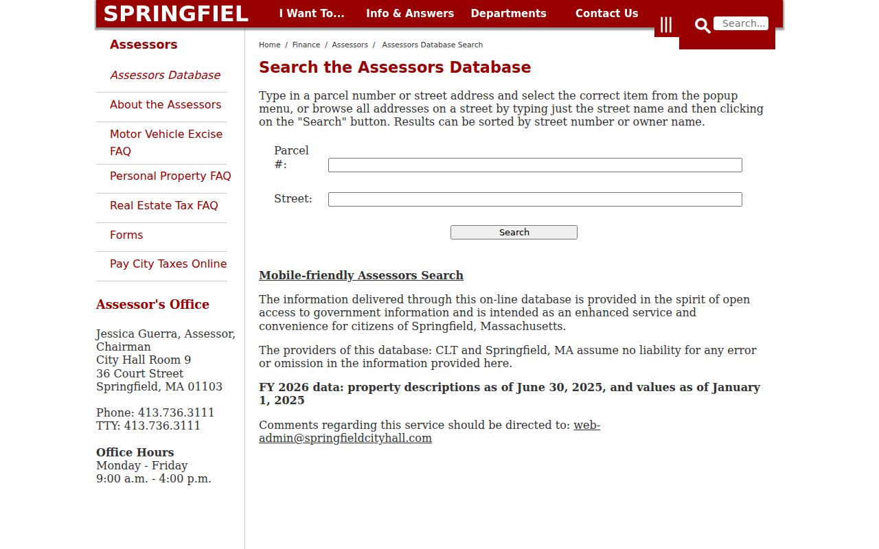
Use the returned address list as an assessment index, then date the card before matching it to a deed image or an older printed listing.
Note: The assessor describes FY2026 property data with a June 30, 2025 description date and January 1, 2025 value date.
Hampden Street Records at Each Address
Several address-keyed sources can answer different parts of a Hampden by-street question. The useful result is a documented trail, not a merged list of people. Start with the municipal source for the property, then use the county Registry for recorded land instruments. For a city-held file that has no verified public portal, the correct route is a targeted request to the municipality or its records access officer.
| Address record | Custodian | What it can show | Access channel |
|---|---|---|---|
| Parcel card | Springfield Assessor | PID, situs, assessed owner and mailing address, class, values, structure details, and comparable sales. | Municipal web search; city contact for records. |
| Parcel and layer map | Springfield GIS | Selected parcel, abutters, dimensions, neighborhood, zoning, services, and a property-card link. | Public viewer and map export controls. |
| Recorded land instruments | Hampden County Registry of Deeds | Deeds, mortgages, liens, plans, easements, book/page, and party roles. | Online index and images, office, mail, and electronic recording routes. |
| Annual street listing | Springfield Elections | Municipal census and street-list process, subject to voter-data rules and limits. | City Hall submission channels; individual state status lookup. |
| Historic city directories | Springfield City Library | Dated resident, boarder, business, or occupant clues for an address. | Library collection, reference help, microfilm, and listed digital resources. |
| Permits or code files | Relevant city or town department | Existing address-specific municipal records, if held. | Department inquiry or Public Records Law request. |
Hampden County has 23 municipalities, and the Springfield tools do not substitute for the other municipal assessors. A street search should always preserve both the municipality and postal place, especially near borders or where a place name is also a neighborhood name.
Hampden Streets Across Parcel Maps
A Springfield parcel card carries more than a name and address. The inspected card for PID 121500021 displays a situs, assessed owner and mailing address, class, neighborhood, land and building values, building facts, room detail, outbuildings, and comparable sales. These fields help distinguish the physical parcel from a mailing location. They do not turn the card into a current household record, and they do not replace the deed or plan for legal title or a boundary question.
The Springfield parcel-card example illustrates the field groups available when an address is tied to a PID.
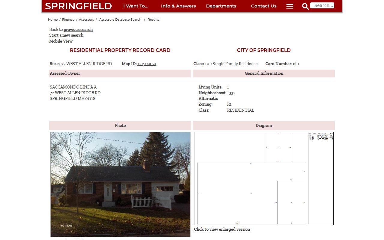
A card can support a precise citation, such as a PID, source date, and visible label, without copying unnecessary personal details into an address-research note.
Hampden Address Fields Need Separate Labels
One of the easiest Hampden address-search mistakes is to collapse several address fields into one. The assessor uses the situs for the parcel location and may show a different owner mailing address. A Registry instrument may identify a legal description, lot, plan, or municipality code. USPS is the right source for a mailing-address and ZIP check. Historical directories and census schedules capture the address as it appeared at publication or enumeration time. They should remain separate in notes and citations.
- Parcel or PID
- A municipal identifier for a mapped property. It connects a card to GIS details but is not a deed number.
- Situs address
- The physical address attached to a parcel for assessment or mapping purposes.
- Mailing address
- The address used by the assessment office for its correspondence with the assessed owner.
- Legal description
- The deed or plan language that identifies land, often by lot, bounds, or recorded plan reference.
- Criss-cross directory
- A historical address-oriented directory that can point to a dated resident or business entry.
Insider tip. The inspected card for PID 008900035 lists 27 Balfour Drive as the situs and 542 Parker Street as the assessed owner mailing address. Those two labels are different facts, so neither one proves where a person currently lives.
Hampden Street Abutter Tools
Springfield GIS can start with an address or street, offer typeahead and closest matches, and open Parcel Details after a selection. For the area around a parcel, its tools include Find Abutters, Abutter Distance, Add Subject Parcels, Add or Remove Parcel, Print Labels, and Export List. The map also offers layers for neighborhood polygons, zoning, historic districts, parks, schools, fire stations, wetlands, service areas, parcel dimensions, common ownership, and aerial imagery. That makes it useful for a by-street investigation of the built environment and adjacent parcels.
The statewide MassGIS Property Map adds a broader parcel view across all 351 Massachusetts municipalities and shows a fiscal year in its popup.
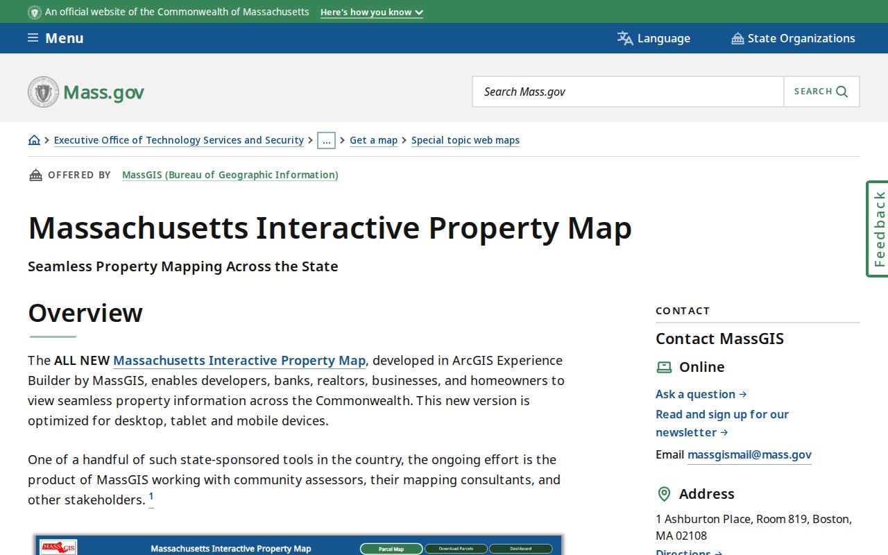
MassGIS is a discovery and comparison tool. The research notes direct users back to the municipal assessor for current assessment data and to recorded documents or a surveyor for an authoritative title or boundary question.
Note: An aerial image, including Springfield's March 2025 capture, shows visual context and does not establish ownership, occupancy, or construction date.
Hampden Street Deed Chain
The Hampden County Registry of Deeds search is the recorded-title route after an assessor or GIS result identifies a parcel and address. Its documented search modes include Name, Address, Book & Page, Year & Instrument #, and Entry Date. The current workflow is fully indexed online after 1948. Earlier work uses scanned grantor and grantee indexes, then book-and-page images or the office's older access materials. A returned instrument can identify party role, document type, municipality code, recording date, and book/page placement.
For a street chain, find the deed linked to the current owner or address, read the grantor as the prior transferor, and search that party as a prior grantee. A probate file at Hampden Probate and Family Court can explain a change where a new deed does not tell the whole story. The Registry offers both Springfield and Westfield offices, along with online, counter, mail, and electronic routes for its land-record functions. Its search instructions say records run from 1636 to today, while the FAQ says 1731, so cite the source and verify an earliest-date claim with the Registry.
Hampden Street History in Directories
For a historic address, Springfield City Library's near-complete directory run from 1866 through 1989 is the key local shelf. Search an address in a reverse or criss-cross volume, read the resident, boarder, business, or occupant entry as a dated clue, and compare the years on either side. Follow a street name as printed. Street names, directionals, suffixes, unit numbers, old municipal boundaries, and postal labels should not be silently normalized away.
A historical directory entry is not a deed and does not establish a person remained at the address. Pair it with census, newspaper, deed, probate, or vital-record evidence according to the question. The library's directories, newspapers, yearbooks, microfilm, and reference help are covered in more depth in the Hampden city directories collection.
The Springfield Republican archive has a documented September 1946 press-strike gap. If a newspaper search does not return an item near that period, preserve that gap rather than treating silence as proof that no event occurred.
Hampden Street Listings Have Limits
Massachusetts handles voter information through more than a single street search. The statewide voter-status tool checks an individual using first name, last name, date of birth, a five-digit residential ZIP, and an acknowledgment. Search tips advise trying the registered spelling or a prior ZIP after a move and allowing two to three weeks for changes. M.G.L. c.51 §47C identifies central-registry and street-list fields, while 950 CMR 58.00 governs security and accuracy. The research did not locate a verified countywide public voter-file form, fee, delivery format, or complete result schema.
Myth. Springfield's annual street listing is not a record of ballot choices or an unrestricted, current-resident database. Springfield Elections manages its annual January 1 census and street-list process through City Hall, mail, fax, email, and drop-off channels. Treat a voter result as a limited, date-sensitive official status record and protect fields that the custodian does not publish.
Hampden Street Postal Labels
A Hampden street can carry a city name, a neighborhood name, and a postal-place label that do not mean the same thing. Indian Orchard is a Springfield neighborhood and ZIP place, while Feeding Hills is an Agawam postal place. Thorndike and Three Rivers are Palmer postal places, and Woronoco is a Russell postal place. Those labels can be useful search variants, but a ZIP-name match does not establish a municipal boundary or parcel ownership.
Use USPS ZIP Code Lookup to check mailing syntax and the postal relationship for a particular address. MassGIS ZIP polygons are useful map aids, yet the research says they are address-point based, can overlap municipalities, and are not legal boundaries or Census ZCTAs.
Hampden Address Records by Request
No verified countywide public portal was found for municipal permits, code enforcement, cemetery records, animal licenses, or local assumed-name records. That absence is a routing instruction, not a finding that the records never exist. Ask the city or town department, clerk, building office, cemetery custodian, or records access officer for existing records held for the precise address, municipality, and time period. Springfield's Public Information office lists NextRequest, email, and mail routes and links to municipal property, tax, police, and other resources.
Massachusetts Public Records Law, M.G.L. c.66 §10, provides the written-request framework. A focused request should state the street address, any PID, the desired record type, date range, and preferred electronic format. Agencies generally respond within ten business days under the statutory process, with fees, redactions, and appeal procedures governed by the law.
Hampden Street Directory Privacy Boundaries
A Hampden street directory cannot show every person at an address. Some household members may not appear on an assessor card. Massachusetts RMV information is restricted by the federal Driver's Privacy Protection Act, and utility customer lists are not public. A mailing address can differ from a situs, a historical directory may show a past occupant, and a recorded instrument identifies a party role on a document. Use each label for what it says, not for a broader claim.
Massachusetts Address Confidentiality Program protections under M.G.L. c.9A and 950 CMR 130.00, along with SJC Rule 1:20, can produce substitute or impounded addresses. A missing address can be a safety protection rather than an error. Public-record exemptions under M.G.L. c.4 §7 also limit what may be released or republished.
Lawful use. Use address records for personal, lawful research, family history, property curiosity, or civic questions. Do not use a Hampden street directory to watch, stalk, harass, or intimidate anyone.