
Hampden Neighbors: Block Record Sources
Records around a Hampden County address are divided among municipal and state custodians. A parcel map answers where the adjoining lots are and which details the map displays. An assessment card can label an assessed owner and mailing address. The Registry establishes recorded instrument roles, while library sources can add an older address context. None of these sources is a complete statement of who lives in every home on a block. Read the source label and date before comparing results.
| Block source | What it records near an address | Access route |
|---|---|---|
| Springfield GIS | Selected parcels, property-card links, abutters, parcel dimensions, common ownership, and map layers. | Public map viewer with search, click, label, and export controls. |
| Springfield Assessor | PID, situs, assessed owner and mailing address, class, values, and structure information for a parcel. | Municipal Parcel # or Street search. |
| Hampden County Registry of Deeds | Recorded deeds, mortgages, liens, plans, easements, and the party roles on those instruments. | Online index and images, Springfield or Westfield office, mail, and electronic routes. |
| Massachusetts voter records | Individual registration status through the state lookup and street-list fields subject to law and custodian limits. | Individual state check or Springfield Elections process. |
| Springfield City Library | Dated directory, newspaper, yearbook, and historical-address clues. | Library holdings, reference help, microfilm, and eligible digital resources. |
| Municipal departments | Existing address-specific files, such as a permit or code record, when held by the correct city or town. | Department inquiry or a written Public Records Law request. |
For properties outside Springfield, begin with the assessor and records office for that municipality. Hampden County's 23 municipalities do not share one current property roll or one local records desk.
Hampden Neighbors Through Springfield GIS
Springfield GIS is designed for an immediate parcel area rather than a countywide resident roll. Enter an Address or Street, choose a typeahead match, and open the selected parcel's details. A direct parcel click also works. From that point, the map can identify the subject parcel and its nearby parcels, then link back to a property card. Preserve the PID, address spelling, selected layers, and the date of the map query with any block research note.
- Find the subject address in Springfield GIS and confirm the selected parcel before reading nearby results.
- Open Parcel Details and note the PID and situs. Use the property-card link to compare municipal assessment fields.
- Select Find Abutters or Abutter Distance, then review the returned parcels one at a time instead of treating an export as a full block roll.
- Use Add Subject Parcels, Add Parcel, Remove Parcel, Print Labels, or Export List only after the map selection matches the research purpose.
- For recorded title history, move from the parcel clue to the Registry. For a wider named-street trail, use the Hampden street directory workflow.
The Springfield GIS parcel-layer view shows the sort of selected-parcel controls and map layers used for a nearby-parcel review.
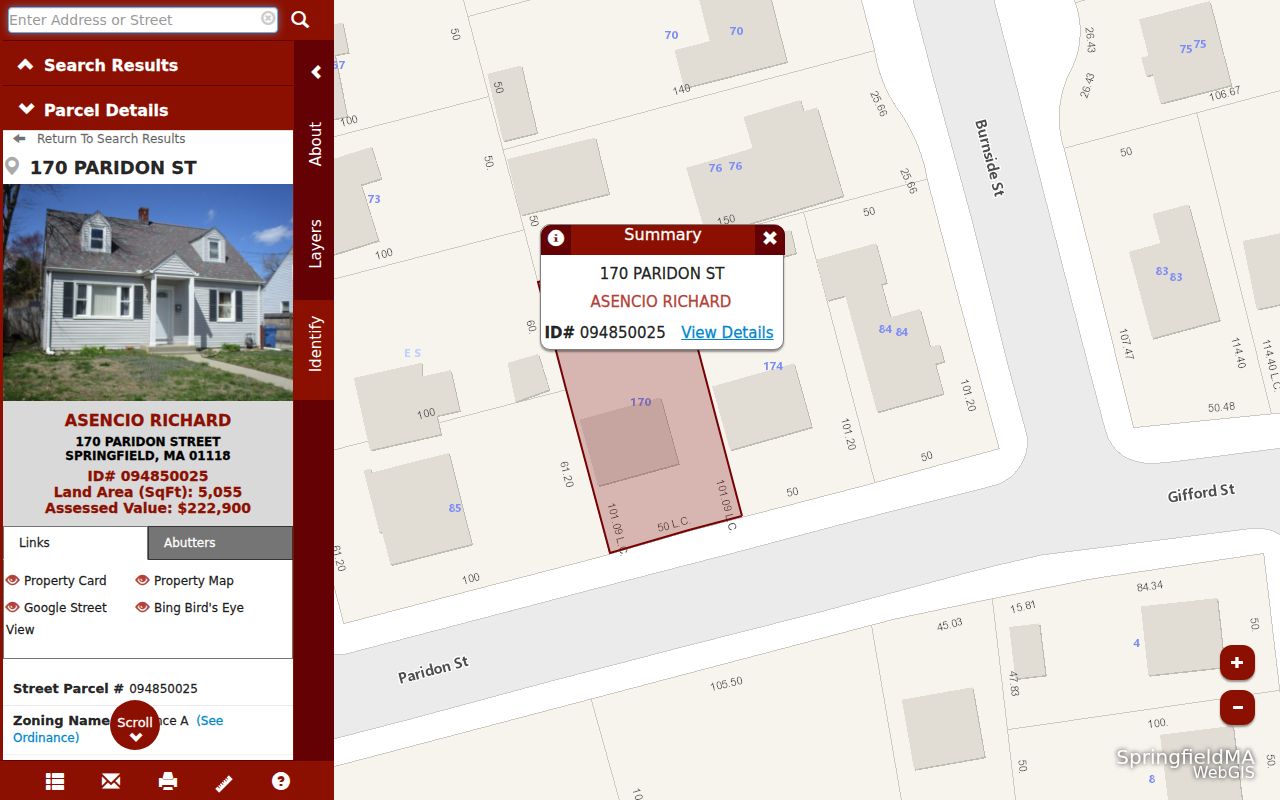
The same viewer offers property-card, abutter, label, and export actions, but its own parcel and map information should not be read as an authoritative legal boundary description.
Hampden Neighbor Parcels Are Dated Records
Assessor data is useful because it displays both a parcel location and assessment fields, yet the labels matter. The Springfield card for PID 008900035 identifies 27 Balfour Drive as the situs while giving 542 Parker Street as the assessed owner mailing address. It also displays the PID, zoning, residential class, land and building data, room details, and comparable sales. That is a clear example of why an owner mailing address, a parcel situs, and a current occupant should never be treated as the same field.
- Situs
- The physical address of the assessed parcel.
- Assessed owner
- The name attached to the assessment record, not a statement of current occupancy.
- Mailing address
- The assessor's correspondence address for that owner.
- PID
- The parcel identifier used to connect an assessment card to GIS research.
- Deed party
- A grantor or grantee role in a recorded document, verified through the Registry.
Insider tip. Record the card's fiscal-year note with its field labels. Springfield's FY2026 descriptions are dated June 30, 2025 and values January 1, 2025, so an assessment result has a known time frame.
Hampden Neighbors and Abutter Results
Find Abutters and Abutter Distance are map functions, not a declaration that every nearby person belongs in a neighbor list. Their value is spatial: they help identify the parcels beside a subject location. Springfield GIS also carries common-ownership parcels and parcel-dimension layers, which can explain why several map shapes or addresses relate to a single tract. Those layers are useful for property curiosity, neighborhood planning, or an estate research trail, but a deed and recorded plan remain the title sources.
Before copying any result, check whether the map selection represents one parcel, a distance calculation, or manually added subject parcels. Springfield GIS supplies aerials, zoning, historic districts, wetlands, schools, service areas, and other layers as well. Each layer adds context to the block, not proof that a particular individual currently resides there.
Note: The map's Aerial 2025 layer was captured in March 2025 and is visual context, not evidence of ownership, occupancy, or building date.
Hampden Neighbors Across 17 Map Areas
Springfield's official materials identify 17 named neighborhoods: Bay, Boston Road, Brightwood, East Forest Park, East Springfield, Forest Park, Indian Orchard, Liberty Heights, McKnight, Memorial Square, Metro Center, Old Hill, Pine Point, Six Corners, Sixteen Acres, South End, and Upper Hill. The GIS neighborhood layer exposes polygons and a NAME field, so it can attach an approximate neighborhood label to a selected parcel. A neighborhood name is a useful map and history clue, but it is not a legal address element.
The Pioneer Valley Planning Commission's Springfield neighborhood plans offer planning context for those areas. The research did not locate a verified public neighborhood-association membership directory, a countywide chamber directory, or a public alumni list. Contact an organization directly for records it actually keeps rather than assuming a neighborhood label opens a member roster.
| Community route | Useful block context | Access boundary |
|---|---|---|
| Springfield GIS neighborhood layer | Named polygon and parcel location context. | Map label only, not a household directory. |
| PVPC neighborhood plans | Local planning and place-identity context. | Planning material, not a member list. |
| Springfield City Library | Directories, local history, newspapers, and yearbooks. | Historical and research access, not a current contact list. |
| Community organization inquiry | Information the organization elects to share about its own activities. | No verified public countywide roster was located. |
Hampden Neighbor Voter Records Have Limits
Massachusetts does not provide a general public block roster through its voter-status lookup. The state tool uses first name, last name, month, day, year of birth, five-digit residential ZIP, and an acknowledgment to check an individual's own registration status and polling information. Search tips suggest registered spelling, a prior ZIP after a move, and a two-to-three-week wait for changes. The full returned-field schema was not captured in the research, so it should not be assumed.
Myth. Springfield's annual January 1 street listing is not a record of ballot choices or an unrestricted inventory of neighbors. M.G.L. c.51 §47C identifies central-registry and street-list fields, and 950 CMR 58.00 governs voter-data security and accuracy. Springfield Elections handles its local annual census and street-list process at City Hall and accepts responses by mail, fax, email, and drop-off.
The Springfield Elections page is the official local source for the annual street-list and census process.
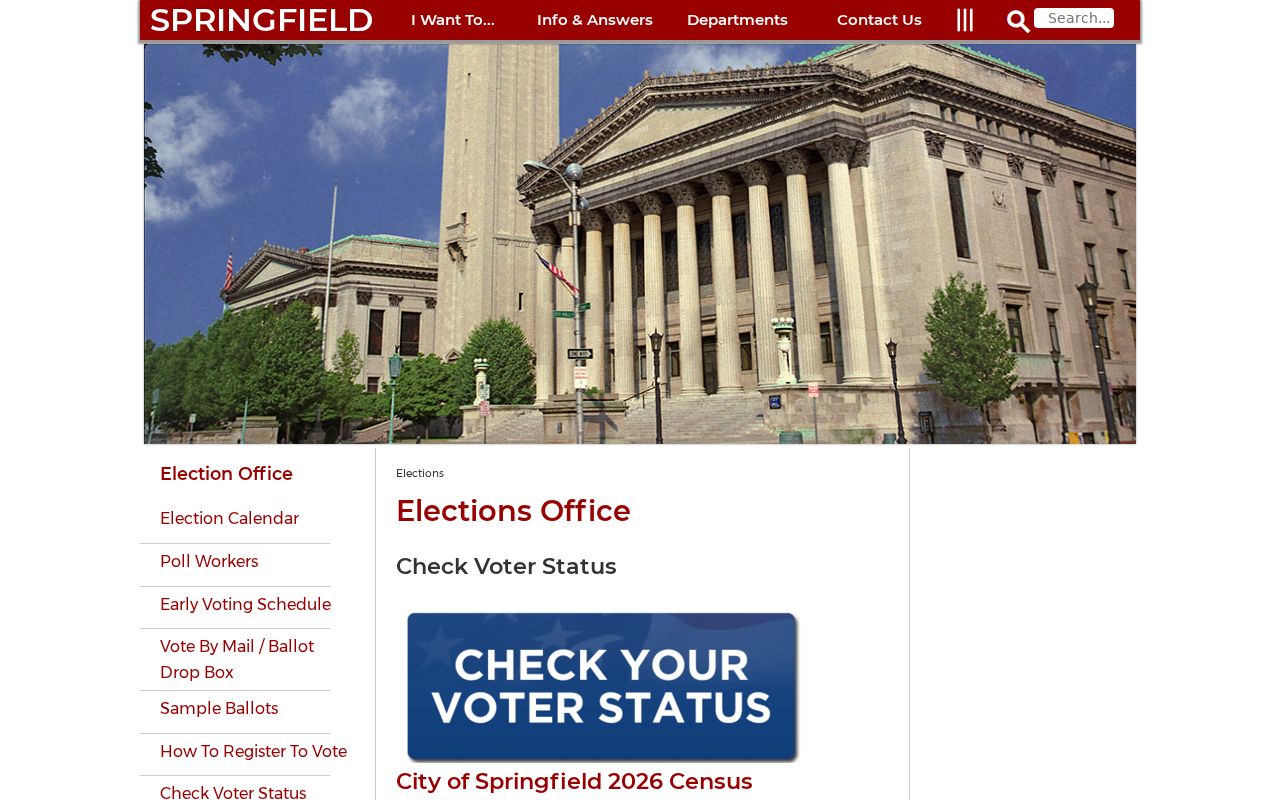
Use the office's published channels for the municipal process, and do not treat the screenshot as a public block-by-block resident list.
Hampden Neighbors Beyond Official Rolls
Official records and commercial people-finder tools are different categories. Official sources identify their custodian, field labels, access limits, and update cycles. Commercial tools may compile public filings, marketing data, and address history, but their accuracy, cost, coverage, and opt-out practices vary. A commercial result is not an authoritative substitute for a municipal assessor, Registry document, voter custodian, or library collection.
| Official source | Commercial people-finder category | Best use of the distinction |
|---|---|---|
| Names the government or repository custodian and record type. | May combine data from several sources with changing methods. | Return to the named custodian before relying on a record. |
| Shows fields and dates tied to a particular parcel, instrument, or collection. | May show an undated or incomplete address history. | Keep the source date and role with every note. |
| Applies public-access and confidentiality limits. | Has provider-specific removal and opt-out procedures. | Use official privacy or correction routes for the underlying record. |
A reliable block note says which record was checked, when, and what it actually records. It does not merge public sources into an unsupported current-household claim.
Hampden Block History in Library Sources
Historical block context comes from dated collections, not a live map. Springfield City Library's directory run spans 1866 through 1989 and can be read by address in reverse or criss-cross volumes. Census records are public through 1950, except for the national loss of most 1890 schedules. Newspaper microfilm, yearbooks, and the Springfield History Library & Archives can help distinguish a historical household, business, or address usage from a present-day parcel record.
For the built environment, the Library of Congress has 1911 Springfield Sanborn volumes that describe building and use context. Those maps can explain what stood near an older address, but they do not identify a current resident. The September 1946 Springfield press strike also creates a newspaper search gap that should be kept in a research log.
Hampden Block Records by Request
When a map points to a file that is not online, request the existing record from the office that holds it. The research found no verified countywide public portal for municipal permits, code enforcement, cemetery data, local assumed-name records, or a complete voter-file request procedure. For Springfield records, the Public Information office provides NextRequest, mail, and email channels and links to property cards, maps and abutters, tax history, liens, and other municipal resources.
Under Massachusetts Public Records Law, M.G.L. c.66 §10, a written request can identify the address, municipality, date range, record type, and preferred electronic format. The law provides a response framework with fee, redaction, and appeal rules. A records access officer can provide existing records, but cannot create a new neighborhood list or release restricted details.
Hampden Neighbors: Privacy Lines
Public parcel and deed records do not make every household detail public. Some household members may not appear on an assessment card. Utility customer lists are not public, and Massachusetts RMV records are restricted under the federal Driver's Privacy Protection Act. A person can also be absent because a source is historical, the custodian has a different record type, or the record is protected. The careful language is assessed to, listed in, or recorded under, followed by the date.
Massachusetts Address Confidentiality Program protections under M.G.L. c.9A and 950 CMR 130.00 can provide a substitute address for eligible participants. SJC Rule 1:20 also permits an ACP substitute address and impoundment in relevant civil proceedings. A missing or substitute address may be a safety measure, not a data error. M.G.L. c.4 §7 exemptions place other limits on release and republication.
Lawful use. Use block records for personal, lawful research, property curiosity, family history, and civic awareness. Do not use information about Hampden neighbors to watch, stalk, harass, or intimidate anyone.